openapi: 3.0.3
info:
title: ArcGIS static basemap tiles service (beta)
description: |
# ArcGIS static basemap tiles
The static basemap tiles service gives you access to Esri's
[ArcGIS](https://developers.arcgis.com/rest/basemap-styles/#arcgis-styles)
styles as rasterized (.png) basemap tiles.
The service provides an endpoint to fetch tiles for each supported style
(for example `/arcgis/streets/static/tile/{level}/{row}/{column}`). To fetch
a basemap tile for your chosen style, supply the desired level, row and
column. Note that, in some systems, a tiling scheme is defined by `x`
(column), `y` (row), `z` (level) which should be arranged as
`/arcgis/streets/static/tile/{z}/{y}/{x}`.
Tiles are supplied as 512x512 .png files in a Web Mercator spatial
reference.
Each style also has a metadata endpoint (for example
`/arcgis/streets/static`) that provides details such as the tiling scheme
and attribution. Basemap attribution is required when building and deploying
mapping applications that use the [Static basemap tiles
service](xref://site.rest/static-basemap-tiles/). There are two types of
attribution that you need to display:
1. _Powered by Esri_.
2. Attribution for the data source providers.
For more details see [Basemap attribution](https://developers.arcgis.com/documentation/mapping-and-location-services/reference/basemap-attribution/).
To access the service, you must use an ArcGIS Location Platform account to
create a token that includes the `premium:user:staticbasemaptiles` privilege.
Note that the service is currently in beta and transitioning to a final release. See the Early Adopter Community
for more information. The V1 endpoints are now available for use.
version: 0.3.1-beta
termsOfService: https://developers.arcgis.com/documentation/mapping-and-location-services/terms-of-use/
servers:
- url: https://static-map-tiles-api.arcgis.com/arcgis/rest/services/static-basemap-tiles-service/{apiVersion}
description: Static basemap tiles service.
variables:
apiVersion:
description: Version of the static basemap tiles service.
enum:
- beta
- v1
default: v1
tags:
- name: arcgis
description: ArcGIS static basemap tiles.
- name: arcgis-metadata
description: Metadata for ArcGIS static basemap tiles.
- name: self-description
description: Information about the service.
security:
- ArcGISTokenParameter: []
- ArcGISAuthorizationHeader: []
- ArcGISXEsriAuthorizationHeader: []
paths:
/self:
get:
tags:
- self-description
responses:
'200':
$ref: '#/components/responses/ServiceSelfResponse'
'401':
$ref: '#/components/responses/UnauthorizedErrorResponse'
'403':
$ref: '#/components/responses/PermissionMissingErrorResponse'
5XX:
$ref: '#/components/responses/ServerErrorResponse'
operationId: ServiceSelfGet
x-arcgis-frontmatter:
keywords:
- style
- basemap
- self
summary: Describes the static basemap tiles service.
description: |
Returns JSON describing the static basemap tiles service.
This self describing endpoint includes details on supported styles,
including the name, thumbnail and a list of supported
languages. The information for each style also includes the URLs to be
used for requesting tiles.
You can use this information to build a dynamic user interface that
presents a user with the available selection of basemap styles.
parameters:
- $ref: '#/components/parameters/TokenParam'
/arcgis/navigation/static/tile/{level}/{row}/{column}:
get:
operationId: arcgisNavigationTileGet
tags:
- arcgis
x-arcgis-frontmatter:
styleName: ArcGIS Navigation
keywords:
- navigation
summary: Static basemap tiles for the ArcGIS Navigation style in PNG format.
description: |
Returns static basemap tiles for the ArcGIS Navigation style in PNG format.
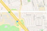
For more information about the style, data providers, attribution, and
terms of use, go to the ArcGIS [item
page](https://www.arcgis.com/home/item.html?id=ad3775594223464abc4addd501a0c5a8).
parameters:
- $ref: '#/components/parameters/LevelParam'
- $ref: '#/components/parameters/RowParam'
- $ref: '#/components/parameters/ColumnParam'
- $ref: '#/components/parameters/LanguageParam'
- $ref: '#/components/parameters/TokenParam'
responses:
'200':
$ref: '#/components/responses/MapTileResponse'
'400':
$ref: '#/components/responses/InvalidQueryErrorResponse'
'404':
$ref: '#/components/responses/NotFoundErrorResponse'
'401':
$ref: '#/components/responses/UnauthorizedErrorResponse'
'403':
$ref: '#/components/responses/PermissionMissingErrorResponse'
5XX:
$ref: '#/components/responses/ServerErrorResponse'
/arcgis/navigation/static:
get:
operationId: arcgisNavigationMetaDataGet
tags:
- arcgis-metadata
x-arcgis-frontmatter:
keywords:
- navigation
summary: Metadata for ArcGIS Navigation static basemap tiles.
description: |
Returns metadata for ArcGIS Navigation static basemap tiles.
parameters:
- $ref: '#/components/parameters/FormatParam'
- $ref: '#/components/parameters/TokenParam'
responses:
'200':
$ref: '#/components/responses/MetaDataResponse'
'400':
$ref: '#/components/responses/InvalidQueryErrorResponse'
'404':
$ref: '#/components/responses/NotFoundErrorResponse'
'401':
$ref: '#/components/responses/UnauthorizedErrorResponse'
'403':
$ref: '#/components/responses/PermissionMissingErrorResponse'
5XX:
$ref: '#/components/responses/ServerErrorResponse'
/arcgis/navigation-night/static/tile/{level}/{row}/{column}:
get:
operationId: arcgisNavigationNightTileGet
tags:
- arcgis
x-arcgis-frontmatter:
styleName: ArcGIS Navigation Night
keywords:
- navigation
- night
summary: Static basemap tiles for the ArcGIS Navigation Night style in PNG format.
description: |
Returns static basemap tiles for the ArcGIS Navigation Night style in PNG format.
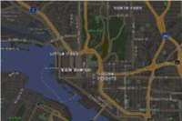
For more information about the style, data providers, attribution, and
terms of use, go to the ArcGIS [item
page](https://www.arcgis.com/home/item.html?id=244d18f67fc046e89d4f04ac839ca56c).
parameters:
- $ref: '#/components/parameters/LevelParam'
- $ref: '#/components/parameters/RowParam'
- $ref: '#/components/parameters/ColumnParam'
- $ref: '#/components/parameters/LanguageParam'
- $ref: '#/components/parameters/TokenParam'
responses:
'200':
$ref: '#/components/responses/MapTileResponse'
'400':
$ref: '#/components/responses/InvalidQueryErrorResponse'
'404':
$ref: '#/components/responses/NotFoundErrorResponse'
'401':
$ref: '#/components/responses/UnauthorizedErrorResponse'
'403':
$ref: '#/components/responses/PermissionMissingErrorResponse'
5XX:
$ref: '#/components/responses/ServerErrorResponse'
/arcgis/navigation-night/static:
get:
operationId: arcgisNavigationNightMetaDataGet
tags:
- arcgis-metadata
x-arcgis-frontmatter:
keywords:
- navigation
- night
summary: Metadata for ArcGIS Navigation Night static basemap tiles.
description: |
Returns metadata for ArcGIS Navigation Night static basemap tiles.
parameters:
- $ref: '#/components/parameters/FormatParam'
- $ref: '#/components/parameters/TokenParam'
responses:
'200':
$ref: '#/components/responses/MetaDataResponse'
'400':
$ref: '#/components/responses/InvalidQueryErrorResponse'
'404':
$ref: '#/components/responses/NotFoundErrorResponse'
'401':
$ref: '#/components/responses/UnauthorizedErrorResponse'
'403':
$ref: '#/components/responses/PermissionMissingErrorResponse'
5XX:
$ref: '#/components/responses/ServerErrorResponse'
/arcgis/streets/static/tile/{level}/{row}/{column}:
get:
operationId: arcgisStreetsTileGet
tags:
- arcgis
x-arcgis-frontmatter:
styleName: ArcGIS Streets
keywords:
- streets
summary: Static basemap tiles for the ArcGIS Streets style in PNG format.
description: |
Returns static basemap tiles for the ArcGIS Streets style in PNG format.
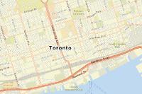
For more information about the style, data providers, attribution, and
terms of use, go to the ArcGIS [item
page](https://www.arcgis.com/home/item.html?id=ab81d22899024ea08c8bb5a88cc1775e).
parameters:
- $ref: '#/components/parameters/LevelParam'
- $ref: '#/components/parameters/RowParam'
- $ref: '#/components/parameters/ColumnParam'
- $ref: '#/components/parameters/LanguageParam'
- $ref: '#/components/parameters/TokenParam'
responses:
'200':
$ref: '#/components/responses/MapTileResponse'
'400':
$ref: '#/components/responses/InvalidQueryErrorResponse'
'404':
$ref: '#/components/responses/NotFoundErrorResponse'
'401':
$ref: '#/components/responses/UnauthorizedErrorResponse'
'403':
$ref: '#/components/responses/PermissionMissingErrorResponse'
5XX:
$ref: '#/components/responses/ServerErrorResponse'
/arcgis/streets/static:
get:
operationId: arcgisStreetsMetaDataGet
tags:
- arcgis-metadata
x-arcgis-frontmatter:
keywords:
- streets
summary: Metadata for ArcGIS Streets static basemap tiles.
description: |
Returns metadata for ArcGIS Streets static basemap tiles.
parameters:
- $ref: '#/components/parameters/FormatParam'
- $ref: '#/components/parameters/TokenParam'
responses:
'200':
$ref: '#/components/responses/MetaDataResponse'
'400':
$ref: '#/components/responses/InvalidQueryErrorResponse'
'404':
$ref: '#/components/responses/NotFoundErrorResponse'
'401':
$ref: '#/components/responses/UnauthorizedErrorResponse'
'403':
$ref: '#/components/responses/PermissionMissingErrorResponse'
5XX:
$ref: '#/components/responses/ServerErrorResponse'
/arcgis/streets-night/static/tile/{level}/{row}/{column}:
get:
operationId: arcgisStreetsNightTileGet
tags:
- arcgis
x-arcgis-frontmatter:
styleName: ArcGIS Streets Night
keywords:
- streets
- night
summary: Static basemap tiles for the ArcGIS Streets Night style in PNG format.
description: |
Returns static basemap tiles for the ArcGIS Streets Night style in PNG format.
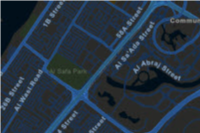
For more information about the style, data providers, attribution, and
terms of use, go to the [item
page](https://www.arcgis.com/home/item.html?id=513cf2cfca4641daac73466f67c9a7dc)
in ArcGIS.
parameters:
- $ref: '#/components/parameters/LevelParam'
- $ref: '#/components/parameters/RowParam'
- $ref: '#/components/parameters/ColumnParam'
- $ref: '#/components/parameters/LanguageParam'
- $ref: '#/components/parameters/TokenParam'
responses:
'200':
$ref: '#/components/responses/MapTileResponse'
'400':
$ref: '#/components/responses/InvalidQueryErrorResponse'
'404':
$ref: '#/components/responses/NotFoundErrorResponse'
'401':
$ref: '#/components/responses/UnauthorizedErrorResponse'
'403':
$ref: '#/components/responses/PermissionMissingErrorResponse'
5XX:
$ref: '#/components/responses/ServerErrorResponse'
/arcgis/streets-night/static:
get:
operationId: arcgisStreetsNightMetaDataGet
tags:
- arcgis-metadata
x-arcgis-frontmatter:
keywords:
- streets
- night
summary: Metadata for ArcGIS Streets Night static basemap tiles.
description: |
Returns metadata for ArcGIS Streets Night static basemap tiles.
parameters:
- $ref: '#/components/parameters/FormatParam'
- $ref: '#/components/parameters/TokenParam'
responses:
'200':
$ref: '#/components/responses/MetaDataResponse'
'400':
$ref: '#/components/responses/InvalidQueryErrorResponse'
'404':
$ref: '#/components/responses/NotFoundErrorResponse'
'401':
$ref: '#/components/responses/UnauthorizedErrorResponse'
'403':
$ref: '#/components/responses/PermissionMissingErrorResponse'
5XX:
$ref: '#/components/responses/ServerErrorResponse'
/arcgis/outdoor/static/tile/{level}/{row}/{column}:
get:
operationId: arcgisOutdoorTileGet
tags:
- arcgis
x-arcgis-frontmatter:
styleName: ArcGIS Outdoor
keywords:
- outdoor
summary: Static basemap tiles for the ArcGIS Outdoor style in PNG format.
description: |
Returns static basemap tiles for the ArcGIS Outdoor style in PNG format.
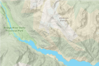
For more information about the style, data providers, attribution, and
terms of use, go to the ArcGIS [item
page](https://www.arcgis.com/home/item.html?id=a409072a313a43b392bb6003b0da5824)
parameters:
- $ref: '#/components/parameters/LevelParam'
- $ref: '#/components/parameters/RowParam'
- $ref: '#/components/parameters/ColumnParam'
- $ref: '#/components/parameters/LanguageParam'
- $ref: '#/components/parameters/TokenParam'
responses:
'200':
$ref: '#/components/responses/MapTileResponse'
'400':
$ref: '#/components/responses/InvalidQueryErrorResponse'
'404':
$ref: '#/components/responses/NotFoundErrorResponse'
'401':
$ref: '#/components/responses/UnauthorizedErrorResponse'
'403':
$ref: '#/components/responses/PermissionMissingErrorResponse'
5XX:
$ref: '#/components/responses/ServerErrorResponse'
/arcgis/outdoor/static:
get:
operationId: arcgisOutdoorMetaDataGet
tags:
- arcgis-metadata
x-arcgis-frontmatter:
keywords:
- outdoor
summary: Metadata for ArcGIS Outdoor static basemap tiles.
description: |
Returns metadata for ArcGIS Outdoor static basemap tiles.
parameters:
- $ref: '#/components/parameters/FormatParam'
- $ref: '#/components/parameters/TokenParam'
responses:
'200':
$ref: '#/components/responses/MetaDataResponse'
'400':
$ref: '#/components/responses/InvalidQueryErrorResponse'
'404':
$ref: '#/components/responses/NotFoundErrorResponse'
'401':
$ref: '#/components/responses/UnauthorizedErrorResponse'
'403':
$ref: '#/components/responses/PermissionMissingErrorResponse'
5XX:
$ref: '#/components/responses/ServerErrorResponse'
/arcgis/light-gray/static/tile/{level}/{row}/{column}:
get:
operationId: arcgisLightGrayTileGet
tags:
- arcgis
x-arcgis-frontmatter:
styleName: ArcGIS Light Gray
keywords:
- light gray
summary: Static basemap tiles for the ArcGIS Light Gray Canvas style in PNG format.
description: |
Returns static basemap tiles for the ArcGIS Light Gray Canvas style in PNG format.

For more information about the style, data providers, attribution, and
terms of use, go to the ArcGIS [item
page](https://www.arcgis.com/home/item.html?id=96ed54f1daf24a6992b7e7317bebd744).
parameters:
- $ref: '#/components/parameters/LevelParam'
- $ref: '#/components/parameters/RowParam'
- $ref: '#/components/parameters/ColumnParam'
- $ref: '#/components/parameters/LanguageParam'
- $ref: '#/components/parameters/TokenParam'
responses:
'200':
$ref: '#/components/responses/MapTileResponse'
'400':
$ref: '#/components/responses/InvalidQueryErrorResponse'
'404':
$ref: '#/components/responses/NotFoundErrorResponse'
'401':
$ref: '#/components/responses/UnauthorizedErrorResponse'
'403':
$ref: '#/components/responses/PermissionMissingErrorResponse'
5XX:
$ref: '#/components/responses/ServerErrorResponse'
/arcgis/light-gray/static:
get:
operationId: arcgisLightGrayMetaDataGet
tags:
- arcgis-metadata
x-arcgis-frontmatter:
keywords:
- light gray
summary: Metadata for ArcGIS Light Gray Canvas static basemap tiles.
description: |
Returns metadata for ArcGIS Light Gray Canvas static basemap tiles.
parameters:
- $ref: '#/components/parameters/FormatParam'
- $ref: '#/components/parameters/TokenParam'
responses:
'200':
$ref: '#/components/responses/MetaDataResponse'
'400':
$ref: '#/components/responses/InvalidQueryErrorResponse'
'404':
$ref: '#/components/responses/NotFoundErrorResponse'
'401':
$ref: '#/components/responses/UnauthorizedErrorResponse'
'403':
$ref: '#/components/responses/PermissionMissingErrorResponse'
5XX:
$ref: '#/components/responses/ServerErrorResponse'
/arcgis/dark-gray/static/tile/{level}/{row}/{column}:
get:
operationId: arcgisDarkGrayTileGet
tags:
- arcgis
x-arcgis-frontmatter:
styleName: ArcGIS Dark Gray
keywords:
- dark gray
summary: Static basemap tiles for the ArcGIS Dark Gray Canvas style in PNG format.
description: |
Returns static basemap tiles for the ArcGIS Dark Gray Canvas style in PNG format.
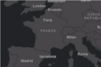
For more information about the style, data providers, attribution, and
terms of use, go to the [item
page](https://www.arcgis.com/home/item.html?id=9a2d2c3012c346b08adf961f18b30c89)
in ArcGIS.
parameters:
- $ref: '#/components/parameters/LevelParam'
- $ref: '#/components/parameters/RowParam'
- $ref: '#/components/parameters/ColumnParam'
- $ref: '#/components/parameters/LanguageParam'
- $ref: '#/components/parameters/TokenParam'
responses:
'200':
$ref: '#/components/responses/MapTileResponse'
'400':
$ref: '#/components/responses/InvalidQueryErrorResponse'
'404':
$ref: '#/components/responses/NotFoundErrorResponse'
'401':
$ref: '#/components/responses/UnauthorizedErrorResponse'
'403':
$ref: '#/components/responses/PermissionMissingErrorResponse'
5XX:
$ref: '#/components/responses/ServerErrorResponse'
/arcgis/dark-gray/static:
get:
operationId: arcgisDarkGrayMetaDataGet
tags:
- arcgis-metadata
x-arcgis-frontmatter:
keywords:
- dark gray
summary: Metadata for ArcGIS Dark Gray Canvas static basemap tiles.
description: |
Returns metadata for ArcGIS Dark Gray Canvas static basemap tiles.
parameters:
- $ref: '#/components/parameters/FormatParam'
- $ref: '#/components/parameters/TokenParam'
responses:
'200':
$ref: '#/components/responses/MetaDataResponse'
'400':
$ref: '#/components/responses/InvalidQueryErrorResponse'
'404':
$ref: '#/components/responses/NotFoundErrorResponse'
'401':
$ref: '#/components/responses/UnauthorizedErrorResponse'
'403':
$ref: '#/components/responses/PermissionMissingErrorResponse'
5XX:
$ref: '#/components/responses/ServerErrorResponse'
/arcgis/imagery/labels/static/tile/{level}/{row}/{column}:
get:
operationId: arcgisImageryLabelsTileGet
tags:
- arcgis
x-arcgis-frontmatter:
styleName: ArcGIS Imagery Labels
keywords:
- imagery
- labels
summary: Static basemap tiles for the ArcGIS Imagery Labels style in PNG format.
description: |
Returns static basemap tiles for the ArcGIS Imagery Labels style in PNG format.
This layer provides a detailed reference layer for the world designed to be overlaid on imagery.

For more information about the style, data providers, attribution, and
terms of use, go to the [item
page](https://esri.maps.arcgis.com/home/item.html?id=e71216afee5045b59e015702a0169183)
in ArcGIS.
parameters:
- $ref: '#/components/parameters/LevelParam'
- $ref: '#/components/parameters/RowParam'
- $ref: '#/components/parameters/ColumnParam'
- $ref: '#/components/parameters/LanguageParam'
- $ref: '#/components/parameters/TokenParam'
responses:
'200':
$ref: '#/components/responses/MapTileResponse'
'400':
$ref: '#/components/responses/InvalidQueryErrorResponse'
'404':
$ref: '#/components/responses/NotFoundErrorResponse'
'401':
$ref: '#/components/responses/UnauthorizedErrorResponse'
'403':
$ref: '#/components/responses/PermissionMissingErrorResponse'
5XX:
$ref: '#/components/responses/ServerErrorResponse'
/arcgis/imagery/labels/static:
get:
operationId: arcgisImageryLabelsMetaDataGet
tags:
- arcgis-metadata
x-arcgis-frontmatter:
keywords:
- imagery
summary: Metadata for Imagery Labels static basemap tiles.
description: |
Returns metadata for Imagery Labels static basemap tiles.
parameters:
- $ref: '#/components/parameters/FormatParam'
- $ref: '#/components/parameters/TokenParam'
responses:
'200':
$ref: '#/components/responses/MetaDataResponse'
'400':
$ref: '#/components/responses/InvalidQueryErrorResponse'
'404':
$ref: '#/components/responses/NotFoundErrorResponse'
'401':
$ref: '#/components/responses/UnauthorizedErrorResponse'
'403':
$ref: '#/components/responses/PermissionMissingErrorResponse'
5XX:
$ref: '#/components/responses/ServerErrorResponse'
/arcgis/oceans/labels/static/tile/{level}/{row}/{column}:
get:
operationId: arcgisOceansLabelsTileGet
tags:
- arcgis
x-arcgis-frontmatter:
styleName: ArcGIS Oceans Labels
keywords:
- oceans
- labels
summary: Static basemap tiles for the ArcGIS Oceans Labels style in PNG format.
description: |
Returns static basemap tiles for the ArcGIS Oceans Labels style in PNG format.
This style is designed to be used as the reference layer for the World Ocean Base map.
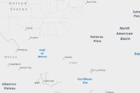
For more information about the style, data providers, attribution, and
terms of use, go to the [item
page](https://www.arcgis.com/home/item.html?id=549bc703f887476c9356a8756068767a)
in ArcGIS.
parameters:
- $ref: '#/components/parameters/LevelParam'
- $ref: '#/components/parameters/RowParam'
- $ref: '#/components/parameters/ColumnParam'
- $ref: '#/components/parameters/LanguageParam'
- $ref: '#/components/parameters/TokenParam'
responses:
'200':
$ref: '#/components/responses/MapTileResponse'
'400':
$ref: '#/components/responses/InvalidQueryErrorResponse'
'404':
$ref: '#/components/responses/NotFoundErrorResponse'
'401':
$ref: '#/components/responses/UnauthorizedErrorResponse'
'403':
$ref: '#/components/responses/PermissionMissingErrorResponse'
5XX:
$ref: '#/components/responses/ServerErrorResponse'
/arcgis/oceans/labels/static:
get:
operationId: arcgisOceansLabelsMetaDataGet
tags:
- arcgis-metadata
x-arcgis-frontmatter:
keywords:
- oceans
- labels
summary: Metadata for ArcGIS Oceans Labels static basemap tiles.
description: |
Returns metadata for ArcGIS Oceans Labels static basemap tiles.
parameters:
- $ref: '#/components/parameters/FormatParam'
- $ref: '#/components/parameters/TokenParam'
responses:
'200':
$ref: '#/components/responses/MetaDataResponse'
'400':
$ref: '#/components/responses/InvalidQueryErrorResponse'
'404':
$ref: '#/components/responses/NotFoundErrorResponse'
'401':
$ref: '#/components/responses/UnauthorizedErrorResponse'
'403':
$ref: '#/components/responses/PermissionMissingErrorResponse'
5XX:
$ref: '#/components/responses/ServerErrorResponse'
/arcgis/community/static/tile/{level}/{row}/{column}:
get:
operationId: arcgisCommunityTileGet
tags:
- arcgis
x-arcgis-frontmatter:
styleName: ArcGIS Community
keywords:
- community
summary: Static basemap tiles for the ArcGIS Community style in PNG format.
description: |
Returns static basemap tiles for the ArcGIS Community style in PNG format.
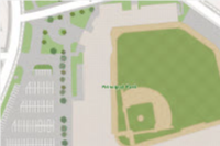
For more information about the style, data providers, attribution, and
terms of use, go to the [item
page](https://www.arcgis.com/home/item.html?id=36551d7048d643618026014f3075327b)
in ArcGIS.
parameters:
- $ref: '#/components/parameters/LevelParam'
- $ref: '#/components/parameters/RowParam'
- $ref: '#/components/parameters/ColumnParam'
- $ref: '#/components/parameters/LanguageParam'
- $ref: '#/components/parameters/TokenParam'
responses:
'200':
$ref: '#/components/responses/MapTileResponse'
'400':
$ref: '#/components/responses/InvalidQueryErrorResponse'
'404':
$ref: '#/components/responses/NotFoundErrorResponse'
'401':
$ref: '#/components/responses/UnauthorizedErrorResponse'
'403':
$ref: '#/components/responses/PermissionMissingErrorResponse'
5XX:
$ref: '#/components/responses/ServerErrorResponse'
/arcgis/community/static:
get:
operationId: arcgisCommunityMetaDataGet
tags:
- arcgis-metadata
x-arcgis-frontmatter:
keywords:
- community
summary: Metadata for ArcGIS Community static basemap tiles.
description: |
Returns metadata for ArcGIS Community static basemap tiles.
parameters:
- $ref: '#/components/parameters/FormatParam'
- $ref: '#/components/parameters/TokenParam'
responses:
'200':
$ref: '#/components/responses/MetaDataResponse'
'400':
$ref: '#/components/responses/InvalidQueryErrorResponse'
'404':
$ref: '#/components/responses/NotFoundErrorResponse'
'401':
$ref: '#/components/responses/UnauthorizedErrorResponse'
'403':
$ref: '#/components/responses/PermissionMissingErrorResponse'
5XX:
$ref: '#/components/responses/ServerErrorResponse'
/arcgis/nova/static/tile/{level}/{row}/{column}:
get:
operationId: arcgisNovaTileGet
tags:
- arcgis
x-arcgis-frontmatter:
styleName: ArcGIS Nova
keywords:
- nova
summary: Static basemap tiles for the ArcGIS Nova style in PNG format.
description: |
Returns static basemap tiles for the ArcGIS Nova style in PNG format.

For more information about the style, data providers, attribution, and
terms of use, go to the [item
page](https://www.arcgis.com/home/item.html?id=6e481fb5345748bb8ff50441eb1afb28)
in ArcGIS.
parameters:
- $ref: '#/components/parameters/LevelParam'
- $ref: '#/components/parameters/RowParam'
- $ref: '#/components/parameters/ColumnParam'
- $ref: '#/components/parameters/LanguageParam'
- $ref: '#/components/parameters/TokenParam'
responses:
'200':
$ref: '#/components/responses/MapTileResponse'
'400':
$ref: '#/components/responses/InvalidQueryErrorResponse'
'404':
$ref: '#/components/responses/NotFoundErrorResponse'
'401':
$ref: '#/components/responses/UnauthorizedErrorResponse'
'403':
$ref: '#/components/responses/PermissionMissingErrorResponse'
5XX:
$ref: '#/components/responses/ServerErrorResponse'
/arcgis/nova/static:
get:
operationId: arcgisNovaMetaDataGet
tags:
- arcgis-metadata
x-arcgis-frontmatter:
keywords:
- nova
summary: Metadata for ArcGIS Nova static basemap tiles.
description: |
Returns metadata for ArcGIS Nova static basemap tiles.
parameters:
- $ref: '#/components/parameters/FormatParam'
- $ref: '#/components/parameters/TokenParam'
responses:
'200':
$ref: '#/components/responses/MetaDataResponse'
'400':
$ref: '#/components/responses/InvalidQueryErrorResponse'
'404':
$ref: '#/components/responses/NotFoundErrorResponse'
'401':
$ref: '#/components/responses/UnauthorizedErrorResponse'
'403':
$ref: '#/components/responses/PermissionMissingErrorResponse'
5XX:
$ref: '#/components/responses/ServerErrorResponse'
/arcgis/midcentury/static/tile/{level}/{row}/{column}:
get:
operationId: arcgisMidcenturyTileGet
tags:
- arcgis
x-arcgis-frontmatter:
styleName: ArcGIS Midcentury
keywords:
- midcentury
summary: Static basemap tiles for the ArcGIS Midcentury style in PNG format.
description: |
Returns static basemap tiles for the ArcGIS Midcentury style in PNG format.
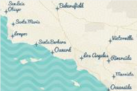
For more information about the style, data providers, attribution, and
terms of use, go to the [item
page](https://www.arcgis.com/home/item.html?id=c97d9da9538b4e6ab9ebbd2fa6e2fd3f)
in ArcGIS.
parameters:
- $ref: '#/components/parameters/LevelParam'
- $ref: '#/components/parameters/RowParam'
- $ref: '#/components/parameters/ColumnParam'
- $ref: '#/components/parameters/LanguageParam'
- $ref: '#/components/parameters/TokenParam'
responses:
'200':
$ref: '#/components/responses/MapTileResponse'
'400':
$ref: '#/components/responses/InvalidQueryErrorResponse'
'404':
$ref: '#/components/responses/NotFoundErrorResponse'
'401':
$ref: '#/components/responses/UnauthorizedErrorResponse'
'403':
$ref: '#/components/responses/PermissionMissingErrorResponse'
5XX:
$ref: '#/components/responses/ServerErrorResponse'
/arcgis/midcentury/static:
get:
operationId: arcgisMidcenturyMetaDataGet
tags:
- arcgis-metadata
x-arcgis-frontmatter:
keywords:
- midcentury
summary: Metadata for ArcGIS Midcentury static basemap tiles.
description: |
Returns metadata for ArcGIS Midcentury static basemap tiles.
parameters:
- $ref: '#/components/parameters/FormatParam'
- $ref: '#/components/parameters/TokenParam'
responses:
'200':
$ref: '#/components/responses/MetaDataResponse'
'400':
$ref: '#/components/responses/InvalidQueryErrorResponse'
'404':
$ref: '#/components/responses/NotFoundErrorResponse'
'401':
$ref: '#/components/responses/UnauthorizedErrorResponse'
'403':
$ref: '#/components/responses/PermissionMissingErrorResponse'
5XX:
$ref: '#/components/responses/ServerErrorResponse'
/arcgis/newspaper/static/tile/{level}/{row}/{column}:
get:
operationId: arcgisNewspaperTileGet
tags:
- arcgis
x-arcgis-frontmatter:
styleName: ArcGIS Newspaper
keywords:
- newspaper
summary: Static basemap tiles for the ArcGIS Newspaper style in PNG format.
description: |
Returns static basemap tiles for the ArcGIS Newspaper style in PNG format.
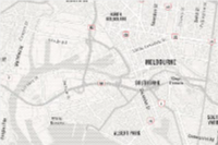
For more information about the style, data providers, attribution, and
terms of use, go to the [item
page](https://www.arcgis.com/home/item.html?id=4ba39bdd9bdb42e1a5c5a0664d6aa4d7)
in ArcGIS.
parameters:
- $ref: '#/components/parameters/LevelParam'
- $ref: '#/components/parameters/RowParam'
- $ref: '#/components/parameters/ColumnParam'
- $ref: '#/components/parameters/LanguageParam'
- $ref: '#/components/parameters/TokenParam'
responses:
'200':
$ref: '#/components/responses/MapTileResponse'
'400':
$ref: '#/components/responses/InvalidQueryErrorResponse'
'404':
$ref: '#/components/responses/NotFoundErrorResponse'
'401':
$ref: '#/components/responses/UnauthorizedErrorResponse'
'403':
$ref: '#/components/responses/PermissionMissingErrorResponse'
5XX:
$ref: '#/components/responses/ServerErrorResponse'
/arcgis/newspaper/static:
get:
operationId: arcgisNewspaperMetaDataGet
tags:
- arcgis-metadata
x-arcgis-frontmatter:
keywords:
- newspaper
summary: Metadata for ArcGIS Newspaper static basemap tiles.
description: |
Returns metadata for ArcGIS Newspaper static basemap tiles.
parameters:
- $ref: '#/components/parameters/FormatParam'
- $ref: '#/components/parameters/TokenParam'
responses:
'200':
$ref: '#/components/responses/MetaDataResponse'
'400':
$ref: '#/components/responses/InvalidQueryErrorResponse'
'404':
$ref: '#/components/responses/NotFoundErrorResponse'
'401':
$ref: '#/components/responses/UnauthorizedErrorResponse'
'403':
$ref: '#/components/responses/PermissionMissingErrorResponse'
5XX:
$ref: '#/components/responses/ServerErrorResponse'
/arcgis/human-geography/static/tile/{level}/{row}/{column}:
get:
operationId: arcgisHumanGeographyTileGet
tags:
- arcgis
x-arcgis-frontmatter:
styleName: ArcGIS Human Geography
keywords:
- human geography
summary: Static basemap tiles for the ArcGIS Human Geography style in PNG format.
description: |
Returns static basemap tiles for the ArcGIS Human Geography style in PNG format.
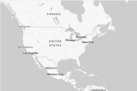
For more information about the style, data providers, attribution, and
terms of use, go to the [item
page](https://esri.maps.arcgis.com/home/item.html?id=6a6bf92e7824417db632aa1d058a13b4)
in ArcGIS.
parameters:
- $ref: '#/components/parameters/LevelParam'
- $ref: '#/components/parameters/RowParam'
- $ref: '#/components/parameters/ColumnParam'
- $ref: '#/components/parameters/LanguageParam'
- $ref: '#/components/parameters/TokenParam'
responses:
'200':
$ref: '#/components/responses/MapTileResponse'
'400':
$ref: '#/components/responses/InvalidQueryErrorResponse'
'404':
$ref: '#/components/responses/NotFoundErrorResponse'
'401':
$ref: '#/components/responses/UnauthorizedErrorResponse'
'403':
$ref: '#/components/responses/PermissionMissingErrorResponse'
5XX:
$ref: '#/components/responses/ServerErrorResponse'
/arcgis/human-geography/static:
get:
operationId: arcgisHumanGeographyMetaDataGet
tags:
- arcgis-metadata
x-arcgis-frontmatter:
keywords:
- human geography
summary: Metadata for ArcGIS Human Geography static basemap tiles.
description: |
Returns metadata for ArcGIS Human Geography static basemap tiles.
parameters:
- $ref: '#/components/parameters/FormatParam'
- $ref: '#/components/parameters/TokenParam'
responses:
'200':
$ref: '#/components/responses/MetaDataResponse'
'400':
$ref: '#/components/responses/InvalidQueryErrorResponse'
'404':
$ref: '#/components/responses/NotFoundErrorResponse'
'401':
$ref: '#/components/responses/UnauthorizedErrorResponse'
'403':
$ref: '#/components/responses/PermissionMissingErrorResponse'
5XX:
$ref: '#/components/responses/ServerErrorResponse'
/arcgis/human-geography-dark/static/tile/{level}/{row}/{column}:
get:
operationId: arcgisHumanGeographyDarkTileGet
tags:
- arcgis
x-arcgis-frontmatter:
styleName: ArcGIS Human Geography Dark
keywords:
- human geography
- dark
summary: Static basemap tiles for the ArcGIS Human Geography Dark style in PNG format.
description: |
Returns static basemap tiles for the ArcGIS Human Geography Dark style in PNG format.
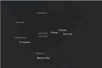
For more information about the style, data providers, attribution, and
terms of use, go to the [item
page](https://esri.maps.arcgis.com/home/item.html?id=69b9605f8a734c6f861148bb8e5a1f40)
in ArcGIS.
parameters:
- $ref: '#/components/parameters/LevelParam'
- $ref: '#/components/parameters/RowParam'
- $ref: '#/components/parameters/ColumnParam'
- $ref: '#/components/parameters/LanguageParam'
- $ref: '#/components/parameters/TokenParam'
responses:
'200':
$ref: '#/components/responses/MapTileResponse'
'400':
$ref: '#/components/responses/InvalidQueryErrorResponse'
'404':
$ref: '#/components/responses/NotFoundErrorResponse'
'401':
$ref: '#/components/responses/UnauthorizedErrorResponse'
'403':
$ref: '#/components/responses/PermissionMissingErrorResponse'
5XX:
$ref: '#/components/responses/ServerErrorResponse'
/arcgis/human-geography-dark/static:
get:
operationId: arcgisHumanGeographyDarkMetaDataGet
tags:
- arcgis-metadata
x-arcgis-frontmatter:
keywords:
- human geography
- dark
summary: Metadata for ArcGIS Human Geography Dark static basemap tiles.
description: |
Returns metadata for ArcGIS Human Geography Dark static basemap tiles.
parameters:
- $ref: '#/components/parameters/FormatParam'
- $ref: '#/components/parameters/TokenParam'
responses:
'200':
$ref: '#/components/responses/MetaDataResponse'
'400':
$ref: '#/components/responses/InvalidQueryErrorResponse'
'404':
$ref: '#/components/responses/NotFoundErrorResponse'
'401':
$ref: '#/components/responses/UnauthorizedErrorResponse'
'403':
$ref: '#/components/responses/PermissionMissingErrorResponse'
5XX:
$ref: '#/components/responses/ServerErrorResponse'
components:
schemas:
Error:
type: object
properties:
error:
description: Error information
type: object
properties:
code:
description: |
A code identifying the type of error.
This can be an HTTP status code, `498` (invalid or expired
token), or `499` (missing token).
type: integer
example: 400
enum:
- 400
- 401
- 403
- 404
- 498
- 499
- 500
message:
description: A message describing the error.
type: string
minLength: 1
example: Parameter invalid.
details:
description: List of details about the error.
type: array
items:
type: string
minItems: 0
required:
- code
- message
required:
- error
ServiceSelf:
type: object
description: A JSON structure which describes the static basemap tiles service. Includes a list of all supported styles.
properties:
languages:
description: |
List of languages that are supported by certain basemap styles. The language code can be set in the `language` query parameter for tile requests of supported styles.
Check the array of `supportedLanguageCodes` for a style to see which
languages are available.
type: array
items:
type: object
properties:
name:
description: Name of the language.
type: string
example: French
code:
description: Code for the language.
type: string
example: fr
styles:
description: list of provided styles that can be used.
type: array
items:
type: object
$ref: '#/components/schemas/StylesItemSelf'
required:
- languages
- styles
StylesItemSelf:
type: object
description: Describes a given style.
properties:
name:
description: Name of the style.
type: string
example: ArcGIS Navigation
path:
description: Endpoint path used to access the style.
type: string
example: /arcgis/navigation
provider:
description: The style provider.
type: string
enum:
- arcgis
example: arcgis
url:
description: |
Full URL to the style metadata.
This can be used with mapping clients that read the tiling scheme
etc. from the metadata XML as the entry point for fetching tiles
(for example, the ArcGIS Maps SDKs).
You can append the `language` query parameter to this style, using
the codes shown in the `supportedLanguageCodes` property for the
style.
Append the `token` query parameter to this style to authenticate
tile requests.
type: string
format: URL
example: https://static-map-tiles-api.arcgis.com/arcgis/rest/services/static-basemap-tiles-service/v1/arcgis/navigation/static
templateUrl:
description: |
Template URL for fetching a tile from the style
This can be used with mapping clients that form tile requests using
the `{x}/{y}/{z}` syntax (for example, Cesium JS, OpenLayers, Leaflet
and MapLibre). Note that the order of arguments for this service is
`{z}/{y}/{x}` where `z` equates to the `level` path parameter, `y`
is `row` and `x` is `column`.
You can append the `language` query parameter to this style, using
the codes shown in the `supportedLanguageCodes` property for the
style.
Append the `token` query parameter to this style to authenticate
tile requests.
type: string
format: URL
example: https://static-map-tiles-api.arcgis.com/arcgis/rest/services/static-basemap-tiles-service/v1/arcgis/navigation/static/tile/{z}/{y}/{x}
thumbnailUrl:
description: Link to a thumbnail JPG for the style.
type: string
format: URL
example: https://www.arcgis.com/sharing/rest/content/items/ea3befe305494bb5b2acd77e1b3135dc/info/thumbnail/thumbnail1607389425104.jpeg
supportedLanguageCodes:
description: |
A list of the language codes that are supported for this style.
Language codes can be passed to a given style with the `language`
query parameter. You can see full details of a given language,
including it's display name in the top-level `languages` property
for the service's `self` endpoint.
If this array is empty for a give style, only the default language
for the basemap is supported.
type: array
items:
type: string
minItems: 0
example:
- fr
- de
description:
description: A description of the style.
type: string
example: This layer provides a detailed basemap for the world featuring a custom navigation map style.
required:
- name
- path
- provider
- thumbnailUrl
- url
- templateUrl
- supportedLanguageCodes
MetaData:
type: object
description: |
The metadata.
properties:
serviceDescription:
description: A description of the static basemap tiles service.
type: string
mapName:
description: The name of the basemap style.
type: string
example: ArcGIS Streets
description:
description: A description of the map.
type: string
example: This layer provides a detailed basemap for the world symbolized with a classic Esri street map style.
copyrightText:
description: Copyright information for the map.
type: string
example: 'Sources: Esri, TomTom, Garmin, FAO, NOAA, USGS, © OpenStreetMap contributors, and the GIS User Community'
supportsDynamicLayers:
description: Whether the service supports dynamic layers.
type: boolean
example: false
spatialReference:
description: The spatial reference of the map.
$ref: '#/components/schemas/SpatialReference'
singleFusedMapCache:
description: Whether the service has a single fused map cache.
type: boolean
example: true
tileInfo:
description: The tile information of the service.
$ref: '#/components/schemas/TileInfo'
initialExtent:
description: The initial extent of the service.
$ref: '#/components/schemas/Extent'
fullExtent:
description: The full extent of the service.
$ref: '#/components/schemas/Extent'
minScale:
description: A number representing the minimum scale at which the layer will be visible. The number is the scale's denominator.
minimum: 0
example: 0
maxScale:
description: A number representing the maximum scale at which the layer will be visible. The number is the scale's denominator.
minimum: 0
example: 0
units:
description: Units used by the service.
type: string
enum:
- esriMeters
supportedImageFormatTypes:
description: The image format types supported by the service when generating a map image.
type: string
example: PNG
documentInfo:
description: Information about the service.
$ref: '#/components/schemas/DocumentInfo'
capabilities:
description: The service's capabilities.
type: string
example: Map
exportTilesAllowed:
description: Whether exporting tiles in compact format (.tpk) is supported.
type: boolean
example: false
maxRecordCount:
description: The maximum number of records that will be returned at once for a query.
type: integer
example: 100
maxImageHeight:
description: The maximum image height in pixels.
type: integer
example: 512
maxImageWidth:
description: The maximum image width in pixels.
type: integer
example: 512
SpatialReference:
type: object
description: A spatial reference.
required:
- wkid
properties:
wkid:
description: The well-known ID (WKID) of the coordinate system.
type: integer
example: 102100
latestWkid:
description: Identifies the current wkid value associated with the same spatial reference. For example a WKID of '102100' (Web Mercator) has a latestWKid of '3857'.
type: integer
example: 3857
TileInfo:
type: object
description: Tile information, returned from the service.
properties:
rows:
type: integer
description: Requested tile's row.
example: 512
cols:
type: integer
description: Requested tile's column.
example: 512
dpi:
type: number
description: The dpi of the tiling scheme.
example: 96
compressionQuality:
type: number
description: Compression quality of the tile.
minimum: 0
maximum: 100
example: 75
format:
type: string
description: Image format of the tile.
enum:
- PNG
lods:
type: array
description: An array of levels of detail that define the tiling scheme.
items:
type: object
$ref: '#/components/schemas/LevelOfDetail'
uniqueItems: true
origin:
type: object
description: The tiling scheme origin.
$ref: '#/components/schemas/Point'
spatialReference:
type: object
description: The spatial reference of the tiling schema.
$ref: '#/components/schemas/SpatialReference'
additionalProperties: false
LevelOfDetail:
type: object
description: A level of detail (LOD) in a tiling scheme.
properties:
level:
type: integer
description: ID for each level.
example: 6
resolution:
type: number
description: Resolution in map units of each pixel in a tile for each level.
example: 1222.992452562495
scale:
type: number
description: Scale for each level.
example: 4622324.434309
additionalProperties: false
Point:
properties:
m:
type: number
description: M coordinate which contains measures used for linear referencing.
spatialReference:
type: object
description: The spatial reference can be defined using a well-known ID (WKID) or well-known text (WKT).
$ref: '#/components/schemas/SpatialReference'
x:
description: X coordinate which is measured along the east/west axis.
type: number
y:
type: number
description: Y coordinate which is measured along the north/south axis.
z:
type: number
description: Z coordinate which measures height or elevation.
required:
- x
- y
additionalProperties: false
Extent:
description: Defines a bounding geometry given the lower-left and upper-right corners of the bounding box.
properties:
spatialReference:
type: object
description: An object used to specify the spatial reference of the given geometry.
$ref: '#/components/schemas/SpatialReference'
xmax:
type: number
description: A numeric value indicating the top-right X-coordinate of an extent envelope.
example: 20037507.22959434
xmin:
description: A numeric value indicating the bottom-left X-coordinate of an extent envelope.
type: number
example: -20037507.22959434
ymax:
type: number
description: A numeric value indicating the top-right Y-coordinate of an extent envelope.
example: 19971868.880408563
ymin:
type: number
description: A numeric value indicating the bottom-left Y-coordinate of an extent envelope.
example: -19971868.880408563
additionalProperties: false
DocumentInfo:
description: Provides various information about the service such as title, author, keywords and comments.
properties:
Title:
description: The document title.
type: string
example: ArcGIS Streets
Author:
description: The document author.
type: string
example: Esri
Comments:
type: string
description: The document comments.
Subject:
type: string
description: The document subject.
example: imagery, satellite, aerial
Category:
type: string
description: The document category.
example: imageryBaseMapsEarthCover (Imagery, basemaps, and land cover)
AntialiasingMode:
description: The anti-aliasing mode.
type: string
enum:
- None
- Fastest
- Fast
- Normal
- Best
TextAntialiasingMode:
description: The text anti-aliasing mode.
type: string
enum:
- None
- Normal
- Force
Keywords:
description: The document keywords.
type: string
example: World,Global,United States
securitySchemes:
ArcGISTokenParameter:
type: apiKey
in: query
name: token
description: |
The authentication token, created from an ArcGIS Location Platform account, with the `premium:user:staticbasemaptiles` [privilege](https://developers.arcgis.com/rest/users-groups-and-items/privileges.htm), used to access the static basemap tiles service.
The `token` parameter can be either an API Key or short-lived token. See
[ArcGIS security
documentation](https://developers.arcgis.com/documentation/mapping-apis-and-services/security/)
for more information on authenticating with a token or API key.
ArcGISAuthorizationHeader:
type: http
scheme: bearer
bearerFormat: 'Authorization: Bearer <YOUR_TOKEN>'
description: |
The authentication token, created from an ArcGIS Location Platform account, with the `premium:user:staticbasemaptiles` [privilege](https://developers.arcgis.com/rest/users-groups-and-items/privileges.htm), used to access the static basemap tiles service.
The authorization parameter can be either an API Key or short-lived token. See
[ArcGIS security
documentation](https://developers.arcgis.com/documentation/mapping-apis-and-services/security/)
for more information on authenticating with a token or API key.
Supply the token in the request header using the "Bearer" scheme:
`Authorization: Bearer <YOUR_TOKEN>`
See [this
topic](https://developers.arcgis.com/documentation/mapping-apis-and-services/security/http-header-authentication/)
for more details on header authentication.
ArcGISXEsriAuthorizationHeader:
type: http
scheme: bearer
bearerFormat: 'X-Esri-Authorization: Bearer <YOUR_TOKEN>'
description: |
The authentication token, created from an ArcGIS Location Platform account, with the `premium:user:staticbasemaptiles` [privilege](https://developers.arcgis.com/rest/users-groups-and-items/privileges.htm), used to access the static basemap tiles service.
The authorization parameter can be either an API Key or short-lived token. See
[ArcGIS security
documentation](https://developers.arcgis.com/documentation/mapping-apis-and-services/security/)
for more information on authenticating with a token or API key.
Supply the token in the request header using the "Bearer" scheme:
`X-Esri-Authorization: Bearer <YOUR_TOKEN>`
See [this
topic](https://developers.arcgis.com/documentation/mapping-apis-and-services/security/http-header-authentication/)
for more details on header authentication.
parameters:
RowParam:
name: row
in: path
description: |
Row index of the tile on the selected level of detail.
The `row` parameter is described as the `y` component in some systems.
required: true
schema:
minimum: 0
type: integer
example: 10
ColumnParam:
name: column
in: path
description: |
Column index of the tile on the selected level of detail.
The `column` parameter is described as the `x` component in some systems.
required: true
schema:
minimum: 0
type: integer
example: 15
LevelParam:
name: level
in: path
description: |
The level of detail (or "tile matrix set") requested for a tile.
The `level` parameter is described as the `z` component in some systems.
Supplying a level of `0` returns the smallest scale of tiles (e.g. the
global scale) and a level of `22` returns ths largest scale (e.g. street
scale).
Note that the static basemap tiles service uses the tiling scheme of the
underlying vector tile service (512x512 pixels), rather than the
traditional image tile scheme (256x256 pixels). This means that static
basemap tiles service zoom levels are 1 less than those of other APIs.
For example: level 12 is equivalent to level 13 for other image map tile
services.
The table below shows the resolution and scale of each level:
level | resolution | scale
--- | --- | ---
0 | 78271.516964 | 1:295828763.795777
1 | 39135.75848199995 | 1:147914381.897889
2 | 19567.87924100005 | 1:73957190.948944
3 | 9783.93962049995 | 1:36978595.474472
4 | 4891.96981024998 | 1:18489297.737236
5 | 2445.98490512499 | 1:9244648.868618
6 | 1222.992452562495 | 1:4622324.434309
7 | 611.496226281245 | 1:2311162.217155
8 | 305.74811314069 | 1:1155581.108577
9 | 152.874056570279 | 1:577790.554289
10 | 76.4370282852055 | 1:288895.277144
11 | 38.2185141425366 | 1:144447.638572
12 | 19.1092570712683 | 1:72223.819286
13 | 9.55462853563415 | 1:36111.909643
14 | 4.777314267817075 | 1:18055.954822
15 | 2.388657133974685 | 1:9027.977411
16 | 1.19432856698734 | 1:4513.9887055
17 | 0.597164283427525 | 1:2256.9943525
18 | 0.2985821417799085 | 1:1128.4971765
19 | 0.1492910708238085 | 1:564.248588
20 | 0.07464553541190416 | 1:282.124294
21 | 0.03732276770595208 | 1:141.062147
22 | 0.01866138385297604 | 1:70.5310735
For more information on levels of detail see [this
page](https://developers.arcgis.com/documentation/mapping-apis-and-services/reference/zoom-levels-and-scale/).
required: true
schema:
minimum: 0
maximum: 22
type: integer
example: 10
TokenParam:
name: token
in: query
description: |
The authentication token, created from an ArcGIS Location Platform account, with the `premium:user:staticbasemaptiles` [privilege](https://developers.arcgis.com/rest/users-groups-and-items/privileges.htm), used to access the static basemap tiles service.
The `token` parameter can be either an API Key or short-lived token. See
[ArcGIS security
documentation](https://developers.arcgis.com/documentation/mapping-apis-and-services/security/)
for more information on authenticating with a token or API key.
Alternatively, you can supply a token in the request header with one of
the following keys using the "Bearer" scheme:
- `Authorization: Bearer <YOUR_TOKEN>`
- `X-Esri-Authorization: Bearer <YOUR_TOKEN>`
schema:
type: string
LanguageParam:
name: language
in: query
description: |
Optional case-sensitive parameter to specify the preferred language for basemap labels.
This query parameter uses language codes to specify the preferred
language. If not set, or if no translation is available, the default
basemap labels will be used.
The language codes use the [CLDR](https://cldr.unicode.org/) (Common
Locale Data Repository) format string that uses a two letter language
code (e.g. "fr" for French) optionally followed by a two letter country
code (e.g. "fr-CA" for French in Canada).
If an unsupported language code is used, then the service will attempt
to fall-back to the closest available language. This is done by
stripping regional and extension sub-tags to find a known language code.
For example, French Canadian (`fr-CA`) is unsupported so this falls back
to French `fr`.
Should the fallback fail, then the service will default to showing
the default basemap labels.
Language codes:
- English - `en`
- Dutch - `nl`
- Danish - `da`
- Finnish - `fi`
- French - `fr`
- German - `de`
- Norwegian - `no` or `nb`
schema:
type: string
enum:
- en
- nl
- da
- fi
- fr
- de
- nb
- no
example: fr
FormatParam:
name: f
in: query
description: |
The requested response format - either `json` or `pjson` (pretty json).
schema:
type: string
default: json
enum:
- json
- pjson
responses:
UnauthorizedErrorResponse:
description: Authentication Error. The API key or token is missing, invalid or expired.
content:
application/json:
schema:
$ref: '#/components/schemas/Error'
ServerErrorResponse:
description: An error occurred on the server.
content:
application/json:
schema:
$ref: '#/components/schemas/Error'
InvalidQueryErrorResponse:
description: Invalid query parameters.
content:
application/json:
schema:
$ref: '#/components/schemas/Error'
NotFoundErrorResponse:
description: The requested resource was not found.
content:
application/json:
schema:
$ref: '#/components/schemas/Error'
PermissionMissingErrorResponse:
description: |
The required parameter 'token' is valid, but does not have permission to access the service.
content:
application/json:
schema:
$ref: '#/components/schemas/Error'
ServiceSelfResponse:
description: A successful response for the root self request.
content:
application/json:
schema:
$ref: '#/components/schemas/ServiceSelf'
MapTileResponse:
description: |
Tile in PNG format with a size of 512 x 512 pixels.
content:
image/png:
schema:
type: string
format: binary
MetaDataResponse:
description: |
Metadata response.
content:
application/json:
schema:
$ref: '#/components/schemas/MetaData'